Rumbling Rabaul – The raging Cauldron of Tavurvur
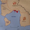
The observatory sits on a hill a little further above the city, from where the world looks less spiritual and the almighty power which determines life on earth is recorded in numbers. The Rabaul Caldera is so much more than just Tavurvur; it is a complex volcanic system. Institute leader Ima shows me a graphic which demonstrates how the magma raised the caldera by an impressive 13cm. The expert soberly talks of inflation, which in this case has epic dimensions since the majority of the growth, ten centimetres, took place in 2011, therefore within the last seven months only.
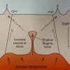
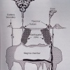
The magma chamber (Harbour LVA) sits at a depth of three to four kilometres and has a biblical volume of 30-35 cubic kilometres. It is connected to a further magma reservoir twelve to eighteen kilometres beneath the earth’s crust. If the earth were an egg, the Rabaul Caldera would be at a weak point in the egg’s skin, while the insides churn and press upwards… During the seismic crisis of 1983-1985 there were 400 earthquakes every day and the Matupit Peninsula (home of the village of the same name) which lies on the volcano was raised by an incredible 1.88 metres.
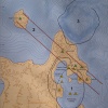
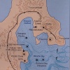
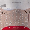
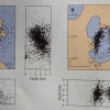
On the basis of Moris algorithm in 2008 institute leader Ima developed a new non-linear algorithm Shak3_na to determine erathquake epicentres even more precise. The visualisation of the tectonic events reveals a simplyfied view of the elliptical ring structure forming the Rabaul caldera, but also shows the inverted keyblock, the rock sitting like a cork in a champaign bottle.
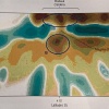
If one considers the speeds of the molten rock moving within the earth, you receive an astoundingly precise 3D visualisation of the volcanic system and the magma underneath the Gazelle Peninsula. There are still stories going around about a gigantic 3000m high Rabaul volcano, however the geological argumentation is very thin as stated by Nairns in 1995.
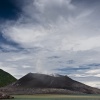
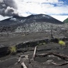
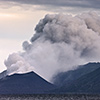
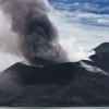
The volcano only recently became active but already Jonathan is messing with me about how I should leave because my showing up woke the volcano. Those kinds of rumours can spread pretty quickly; next thing you know I’ll be chopped up into little pieces. During my stay, the Tavurvur had steady ash eruptions that sometimes reached heights of four kilometres and could be seen all the way from the other end of the Gazelle peninsula, Urara Island.
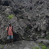
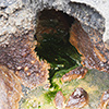
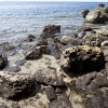
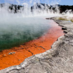
The explosive energy of the Tavurvur is considerable and definitely demands respect, especially when wandering over the razor sharp lava fields at its base, created during 1996 and 2007. My companion Chris also immediately noticed that since the awakening on Wednesday, the sulphur stains on the flanks of the volcano had grown and the fumaroles had not only multiplied but had also become stronger. The Tavurvur is not the only evidence of the earth’s energy. At the north end of the Greet Harbour, the bay between Matupit Island and the volcano, boiling water bubbles from the rocks of the so called “Hot Spring” coast, colouring the normally turquoise water yellow and orange with sulphur, iron and aluminium compounds. Boiling water bubbles to the surface out of the neighbouring Rabalanakaia crater as well.
This place won’t stay as it is for very long though. The same Icelandic company that operates the geothermal power plant at Krafla is extremely interested in tapping into the geothermal energy at the foot of the Tavurvur. At the moment it seems like the sons of guns that spot-drilled into the rhyolitic magma in 2009 might be given the chance to convert geothermal energy into electricity on a large scale.
The area around the Tavurvur is a small desert and the heat continuously fuels perspiration, so much so that the odour emanating from hiking boots is catapulted to a level only surpassed by an over-matured Swiss cheese. Flip-flops are still out of the question though, since the lava fields are razor sharp. It’s still a mystery to me as to how the natives can sometimes walk barefoot on the border of the hot spring or wander on the lava fields. Their calluses must be elephant-like… By the way, one of the reasons the residents of Matupit’s linger in this area is to search for Melanesian mega pode eggs.
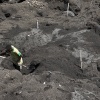
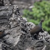
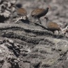
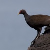
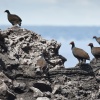
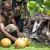
Yes, doesn’t matter if as Schnapps, archipelago, herring or chicken – Bismarck is alive! That very shy bird takes somehow selfishly advantage of the Tavurvur. Whether it’s due to laziness or for protection from predators, the hens bury their eggs deep in the black sand warmed by geothermal energy. The contest over the areas with exactly the correct temperature is even hotter than the volcanic ground itself; after all, the offspring are neither supposed to end up unhatched nor as buried scrambled eggs. However, this doesn’t deter one predator from the offspring: the natives discovered the eggs and now offer the ornate and slightly bitter clutch for two to four Kina at the markets.
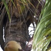
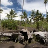
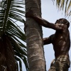
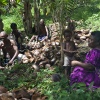
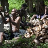
One other lifeline for the residents of Matupit is the coconut. Thomas lives near the wreck of the American “Betty Bomber” and is a master of retrieving the wooden fruit from the palm trees. The 63-year-old shimmies up the palm tree like there’s no tomorrow and greets casually as I barely made it to the two-metre mark. Rehydrating with fruity coconut water after the punishment of the heat and volcanic ash is out of this world.
Volcanic ash – When the volcano is active, it buries Rabaul, the area around the hotel and the village of Matupit on a regular basis. The ash is exactly like the Chinese in Rabaul: omnipresent; to boot it’s incredibly fine, powdery and clogs every pore on the body. Every step stirs up the grey dust. If you breathe it in, you immediately feel the aggressive geochemical concoction in your lungs, and it is sad seeing so many children in Matupit coughing and wheezing like veteran chain smokers.
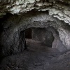
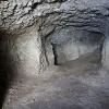
The people of the south-west Pacific really know their Betel nuts. The sour “fruits” of the palm tree are the number one drug, and sometimes lame social lives completely. George and Paul are already noticeably merry when I meet them on the sub base, Cape Tavui, the northernmost point of the Gazelle Peninsula, at 9am. The Japanese defended the peninsula so well during WWII that the Allies were not able to set foot on it. All in all the man-made caves and tunnels around Rabaul are some impressive 500km long.
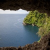
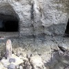
Paul also takes the time to join me in clambering around the caves and paths made by the Japanese in the cliff. The rounded edges in some places reveal the methods of the Japanese; they used palm trunks to form a casing for the reinforced concrete. The Japanese dropped supplies and ammunition at the sub base by submarine under the cover of night, and thereby swam through the Tavui Caldera, still underwater at the time, and landed on the edge, a submerged 300m slope with a steep incline, delivering the load at the top; an exciting place where an inglorious piece of history is within one’s grasp.
